US road asset map

Blyncsy sets out US road asset map.
By MJ Woof November 7, 2024 Read time: 1 min
The new mapping tool from Blyncsy allows open access views of asset data for the entire US


Blyncsy, part of Bentley Systems, has published a public map of the interstate highways in the United States. This shows key roadway assets and can be used to support roadway safety and maintenance works. This data is available to all state US Department of Transportation (DOT) agencies. Using the information means that states to better address road safety, maintenance, and repair operations more efficiently and cost-effectively.

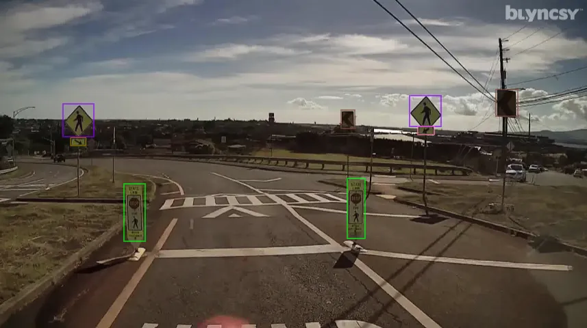
The new Blyncsy interstate highway map uses crowdsourced dash camera imagery from over 1 million vehicles. Coupled with Blyncsy’s powerful AI image analysis toolset, the system is able to detect over 40 different road conditions and asset inventory issues in near-real time. Typical issues include potential roadway safety hazards from damaged guardrail, missing signage, and lack of proper road striping. The system can highlight roadway vulnerabilities to crashes, natural disasters, and work zone areas. 

Blyncsy’s AI-powered crowdsourced data is delivered through an open API, providing state DOTs a solution that is infinitely scalable and cost-efficient when compared to manual data collection technologies like LiDAR, or traditional road inspection, which require maintenance crews in the field to collate data.



 

For more information on companies in this article

Related Content

  • Tampa picks one.network for management
    April 20, 2023
    The Tampa Hillsborough Expressway Authority (THEA) in the US state of Florida is boosting its traffic management, work zone notification and construction planning process.
  • Laser scanning focuses on asset management
    January 9, 2015
    Laser scanners and improved data collection and analysis software are making light of asset management surveying. David Arminas reports The age of the laser scanner is upon us, taking over from traditional manual methods of surveying, data collection and processing. These new technical developments are making it much easier to process and use the data captured and are providing highways engineers with powerful tools to record, map and visualise their assets. This is good news for highways authorities
  • A virtual virtuous circle
    March 19, 2021
    Virtual sensors will allow a safer driving experience and reduce road maintenance costs. Tactile Mobility’s Eitan Grosbard talks to David Arminas
  • Digital transformation is delivering digital adoption
    August 15, 2023
    Digital transformation is key for transportation agencies and their partners to do their jobs better and faster. One way to do this is through digital delivery using digital models, data, and supporting field tools for roadway design, structures design, and construction, say the tech experts at Bentley Systems.