UK consultants, Roughton International, working on behalf of the Uganda National Roads Authority (UNRA), teamed up with Sky High and Traffic Technology to deploy traffic flow data collection equipment suitable for the Ugandan road network.
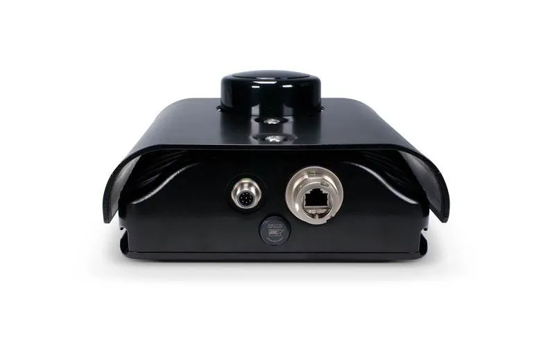
UK consultants, Roughton International, working on behalf of the 1069 Uganda National Roads Authority (UNRA), teamed up with Sky High and Traffic Technology to deploy traffic flow data collection equipment suitable for the Ugandan road network.The UNRA was established in 2008 and has a mandate to develop and maintain the 20,000 km national roads network in Uganda. Uganda's roads carry around 90 per cent of the country's cargo freight and passenger transportation, and not all roads are paved.Road surface conditions were a critical consideration, and in-road sensors were not suitable due to the probability of regular damage. Sky High therefore recommended Traffic Technology's SDR radar traffic classifier to provide accurate vehicle count, classification and speed data because it provides accurate data even on the uneven or broken road surfaces encountered in Uganda.The SDR uses the latest radar technology to accurately detect each vehicle passing the invisible sensor zone, and provides accurate count, classification and speed data for each direction of a bi-directional single carriageway. The equipment installed in Uganda is housed in a robust casing and secured above ground at the roadside.In addition, Traffic Technology supplied the latest Newcomm software, enabling data to be downloaded via the Datacollector using 2362 Bluetooth or GPRS. Data is simply transferred to an SD card and downloaded to the online WebReporter software and speedily output in a range of formats to suit the customer's needs.