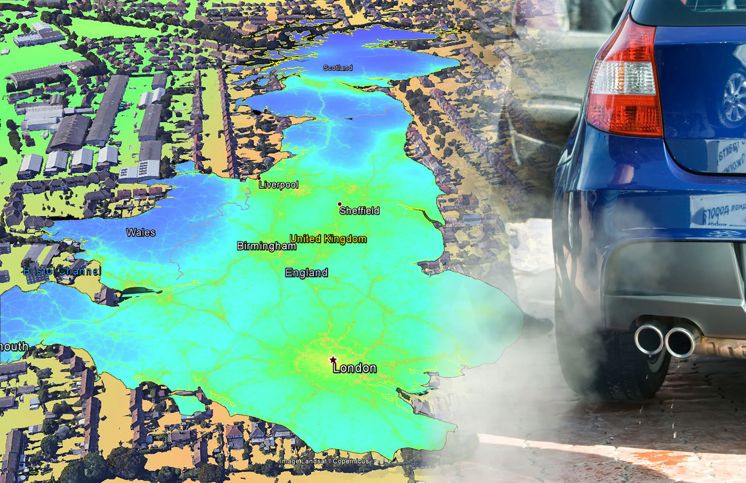
Research carried out jointly by scientists from EarthSense Systems and the University of Leicester shows the beneficial effect of urban trees on helping lower air pollution. The study shows a direct link between air pollution and green infrastructure, with trees and grass cover contributing to a reduction in concentrations of fine particulate matter (PM2.5). The newly published research shows that the aerodynamic dispersive effect of trees results in a 9.0 percent reduction in PM2.5 concentrations. A decrea
Research carried out jointly by scientists from EarthSense Systems and the University of Leicester shows the beneficial effect of urban trees on helping lower air pollution. The study shows a direct link between air pollution and green infrastructure, with trees and grass cover contributing to a reduction in concentrations of fine particulate matter (PM2.5). The newly published research shows that the aerodynamic dispersive effect of trees results in a 9.0 percent reduction in PM2.5 concentrations. A decrease of PM2.5, by 2.8 percent owing to deposition on trees and 0.6% owing to deposition on grass, was also observed.
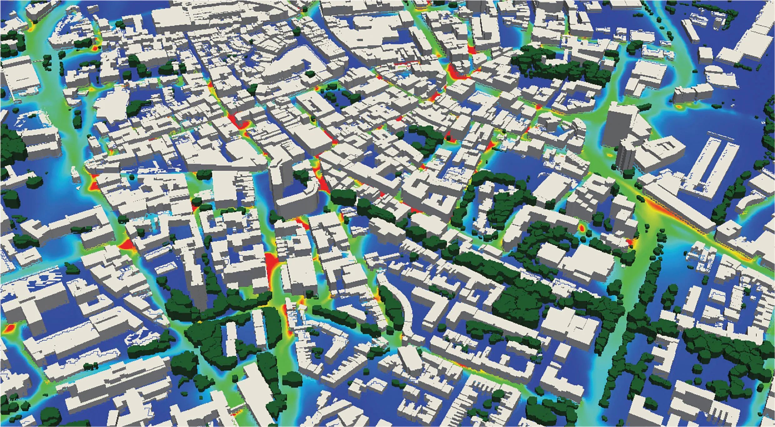
Conducted on a larger scale than previous studies, the project utilised the latest geographic data from aerial mapping company6242 Bluesky, including aerial photography, laser mapped LiDAR and the unique National Tree Map. The University of Leicester led study also used accepted modelling techniques, such as Computational Fluid Dynamics (CFD), already validated for wind flow and particle dispersion modelling.
EarthSense is a new joint venture between Bluesky and the University of Leicester, established to provide commercial access to a range of leading air quality technologies and research.
“This is the first time a study of this scale and nature has been conducted in the UK,” commented Professor Roland Leigh, Technical Director of EarthSense and Director of Enterprise at the University of Leicester’s Institute for Space and Earth Observation. “The results provide valuable information on the interaction of particulate matter and vegetation in the complex urban environment. There are implications on our future modelling of pollutant concentrations, and the structure and positioning of key green infrastructure.”
James Eddy, managing director of EarthSense Systems and technical director at Bluesky, added, “This study shows the part that green infrastructure can play in reducing the effects of harmful traffic emissions in our city centres. When co-ordinated with an understanding of local implementation and traffic planning, this will be significant in shaping future cities.”
Antoine Jeanjean, lead author of the paper and modeller at EarthSense Systems, said, “The use of the most up to date and accurate geographical data, combined with proven modelling techniques on this scale, is a first, and we hope it will inform and influence further studies and real world projects.”
The paper, titled ‘Modelling the effectiveness of urban trees and grass on PM2.5 reduction via dispersion and deposition at a city scale’ by EarthSense Systems’ Antoine Jeanjean – modeller, Paul Monks – non-executive director and Professor Roland Leigh – technical director, has been published in peer reviewed format prior to full publication in the Atmospheric Environment Journal and is available %$Linker:2 External <?xml version="1.0" encoding="utf-16"?><dictionary /> 0 0 0 oLinkExternal here Visit Journal page false http://www.sciencedirect.com/science/article/pii/S1352231016307336 false false %>.
Conducted on a larger scale than previous studies, the project utilised the latest geographic data from aerial mapping company
EarthSense is a new joint venture between Bluesky and the University of Leicester, established to provide commercial access to a range of leading air quality technologies and research.
“This is the first time a study of this scale and nature has been conducted in the UK,” commented Professor Roland Leigh, Technical Director of EarthSense and Director of Enterprise at the University of Leicester’s Institute for Space and Earth Observation. “The results provide valuable information on the interaction of particulate matter and vegetation in the complex urban environment. There are implications on our future modelling of pollutant concentrations, and the structure and positioning of key green infrastructure.”
James Eddy, managing director of EarthSense Systems and technical director at Bluesky, added, “This study shows the part that green infrastructure can play in reducing the effects of harmful traffic emissions in our city centres. When co-ordinated with an understanding of local implementation and traffic planning, this will be significant in shaping future cities.”
Antoine Jeanjean, lead author of the paper and modeller at EarthSense Systems, said, “The use of the most up to date and accurate geographical data, combined with proven modelling techniques on this scale, is a first, and we hope it will inform and influence further studies and real world projects.”
The paper, titled ‘Modelling the effectiveness of urban trees and grass on PM2.5 reduction via dispersion and deposition at a city scale’ by EarthSense Systems’ Antoine Jeanjean – modeller, Paul Monks – non-executive director and Professor Roland Leigh – technical director, has been published in peer reviewed format prior to full publication in the Atmospheric Environment Journal and is available %$Linker: