Swedish study of road pollution

A study carried out in Sweden has highlighted the key risks of road pollution. The study was made by the Swedish Environmental Research Institute (Svenska Miljöinstitutet, IVL) and has shown that wear-and-tear from roads and tyres constitute the largest source of microplastics emissions. Kerstin Magnusson, Ecotoxicologist at the Institute, states that the study, which was conducted on behalf of the Swedish Environmental Protection Agency (Naturvårdsverket), is the largest mapping of microplastics emissions
March 10, 2016 Read time: 1 min
A study carried out in Sweden has highlighted the key risks of road pollution. The study was made by the Swedish Environmental Research Institute (Svenska Miljöinstitutet, IVL) and has shown that wear-and-tear from roads and tyres constitute the largest source of microplastics emissions. Kerstin Magnusson, Ecotoxicologist at the Institute, states that the study, which was conducted on behalf of the Swedish Environmental Protection Agency (Naturvårdsverket), is the largest mapping of microplastics emissions to ever be conducted in Sweden. However the researchers have yet to find out how far these particles reach in the environment. Magnusson said that the study highlights the decreased particle waste from sewage as well as increasing knowledge over other means of particle transports.

Related Content

  • Bitumen challenges and opportunities for the road construction sector
    December 12, 2018
    The road sector faces challenges with regard to bitumen - Gülay Malkoç reports
  • EarthSense Systems releases air pollution map of the UK
    June 15, 2018
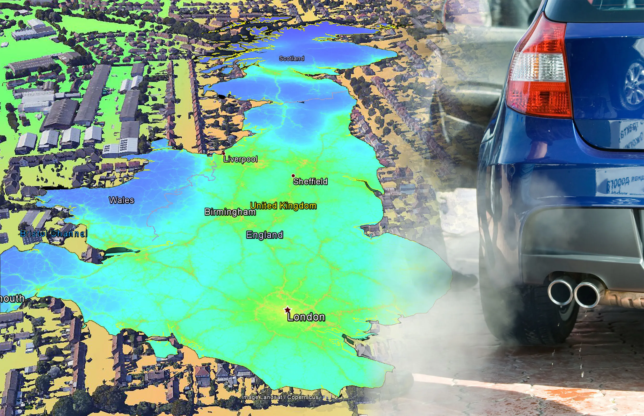
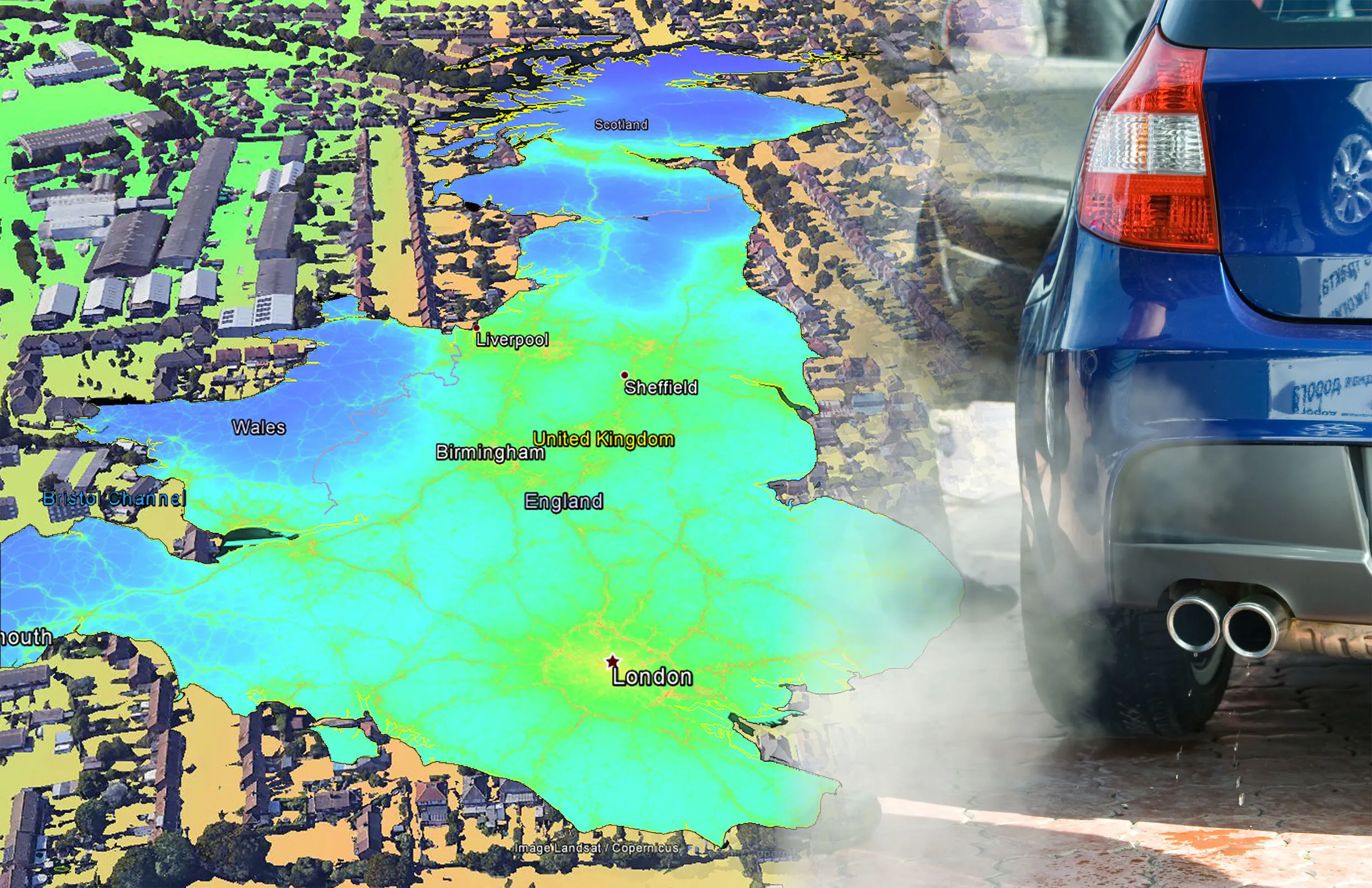
    EarthSense Systems has published MappAir, a high-resolution map of air pollution throughout the entire UK. MappAir shows how air pollution - specifically nitrogen dioxide - changes across the country and within towns and cities, highlighting likely sources and potential clean-air refuge areas. It combines data from satellites and its EarthSense Systems’ own air quality monitoring sensors along with open source data. The result, using complex modelling, creates a highly accurate map at 100m resolution, says
  • EarthSense Systems releases air pollution map of the UK
    June 26, 2018
    EarthSense Systems has published MappAir, a high-resolution map of air pollution throughout the entire UK MappAir shows how air pollution - specifically nitrogen dioxide - changes across the country and within towns and cities, highlighting likely sources and potential clean-air refuge areas. It combines data from satellites and its EarthSense Systems’ own air quality monitoring sensors along with open source data. The result, using complex modelling, creates a highly accurate map at 100m resolution, says
  • Bitumen technology: three ways to more sustainable roads
    May 14, 2020
    This issue we look at three case studies showcasing new technologies designed to deliver more sustainable paving solutions.