Surveying utilities across the UK

Ordnance Survey is surveying utilities across the UK.
By MJ Woof December 11, 2024 Read time: 3 mins
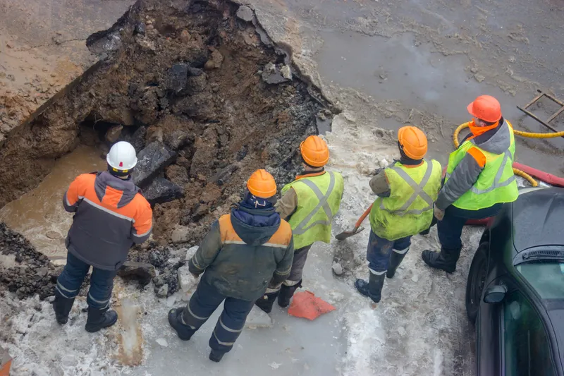
Knowing where utilities are located will help benefit repair works and reduce delays for road users – image courtesy of © Sviatlana Hladkaya| Dreamstime.com


Ordnance Survey will be the future operator of the UK’s National Underground Asset Register. This comprehensive dataset will help speed access to underground utilities, as well as helping in reducing disturbance to traffic for road users by optimising maintenance and reinstatement works.

The National Underground Asset Register (NUAR) is being established to help with the challenges surrounding data sharing, by aggregating England, Wales and Northern Ireland’s underground assets into a single centralised database. AtkinsRéalis was selected as the delivery partner for the build phase of this project following a discovery phase in which the project’s feasibility and economic case were explored and established.

Guy Ledger, project director for the National Underground Asset Register at AtkinsRéalis, which worked with the Geospatial Commission to build the platform, said: “We are extremely proud of the work we have delivered in collaboration with the Geospatial Commission and over the coming months we look forward to supporting the transition to Ordnance Survey, enabling us to continue to build, refine and improve the functionality of the platform.

“Having successfully built a viable working platform, this is a really exciting moment as NUAR transitions to a public beta service giving planners and excavators standardised, secure, instant access to the data they need to carry out work effectively and safely.”

This complex project has three main challenges. It will engage with and collect data from over 700 asset owners and transform and ingest this data into a single comprehensive database. It will then develop a secure portal through which users can view and access this information.

NUAR was predicted to reduce the costs of data-sharing by an estimated £91 million/ year, by  reducing the amount of time and resources asset owners and other stakeholders would have to spend making and answering queries. Understanding this benefit, but also the safety benefits to staff of having all the information available in one place, resulted in a good take-up from utilities providers. This allowed the launch of a minimum viable product (MVP) in spring 2023, which is now live across England and Wales. As more asset owners are onboarded, there is a snowball effect, with the value to asset owners of sharing data with NUAR increasing with each provider we have signed up.

The user portal has been developed collaboratively with users from the beginning as the first users have been onboarded. This is an ongoing process, with the team using a combination of user conversations, testing, and focus groups to help us develop a bespoke solution that will allow these users to access this critical infrastructure data securely and efficiently. Particular focus has gone into making it easy to use on a mobile, based on feedback that this will be a significant proportion of the user base.

ID 138689457
Knowing where utilities are located will help benefit repair works and reduce delays for road users – image courtesy of © Sviatlana Hladkaya| Dreamstime.com

 

For more information on companies in this article

Related Content

  • Asset management can be optimised with new technology
    August 22, 2013
    An array of asset management technologies and capabilities are now available to help clients optimise infrastructure assessments. Global survey and geotechnical group, Fugro, has signed a multi-year agreement with Dutch pavement consultant, KOAC•NPC. This move will see the firms combine capabilities to undertake highway surface condition contracts in the Netherlands. Under the agreement, Fugro will collect surface condition data using its ARAN road scanning vehicle. KOAC•NPC, will carry out the post pro
  • Mersey Gateway shortlisted for the UK’s CIEEM ecology award
    June 1, 2017
    The team building the Mersey Gateway bridge has reached the final of a UK national competition that recognises excellence in ecology and environmental management. The project team entered this year’s Chartered Institute of Ecology and Environmental Management (CIEEM) Best Practice awards. The winners highlight outstanding examples of environmental management on large-scale projects.
  • Our connected and automated future to go under the microscope at RA – IRF Sydney Conference
    May 10, 2018
    As industry and governments around the world continue to grapple with the challenges of vehicle automation, experts will gather in Sydney at the end of May to take stock of progress on the global journey to a new era of mobility. The two-day 2018 Roads Australia (RA) – IRF Regional Conference for Asia and Australasia, to be held over May 31st and June 1st, marks only the second time the two organisations have co-hosted an international event ‘down under’. And with RA playing a key role in helping inform t
  • Award-winning road and bridge design software
    March 20, 2012
    The integration of software tools, users and data was an important factor in a major highway project The giant High Five interchange in Texas, USA, emerged as a key winner in Bentley Systems' software awards this year. It won both the Innovation in Road and Bridge category and, significantly, Connecting Project Teams. The awards, a feature of the annual exhibition/conference organised by the software house, attract increasing interest from industry, and competition has become widespread, not least bec