The Leica iCON gps 80 machine control receiver is a compact and rugged GNSS receiver especially developed for a wide range of machine control applications to increase the overall positioning performance on all construction equipment. It easily and safely fits into any construction machine cabin, communicates seamlessly with all iCONtrol solutions on-site and integrates the iCON telematics fleet management software. The flexible communication provides smooth integration with equipment and solutions for OEM p
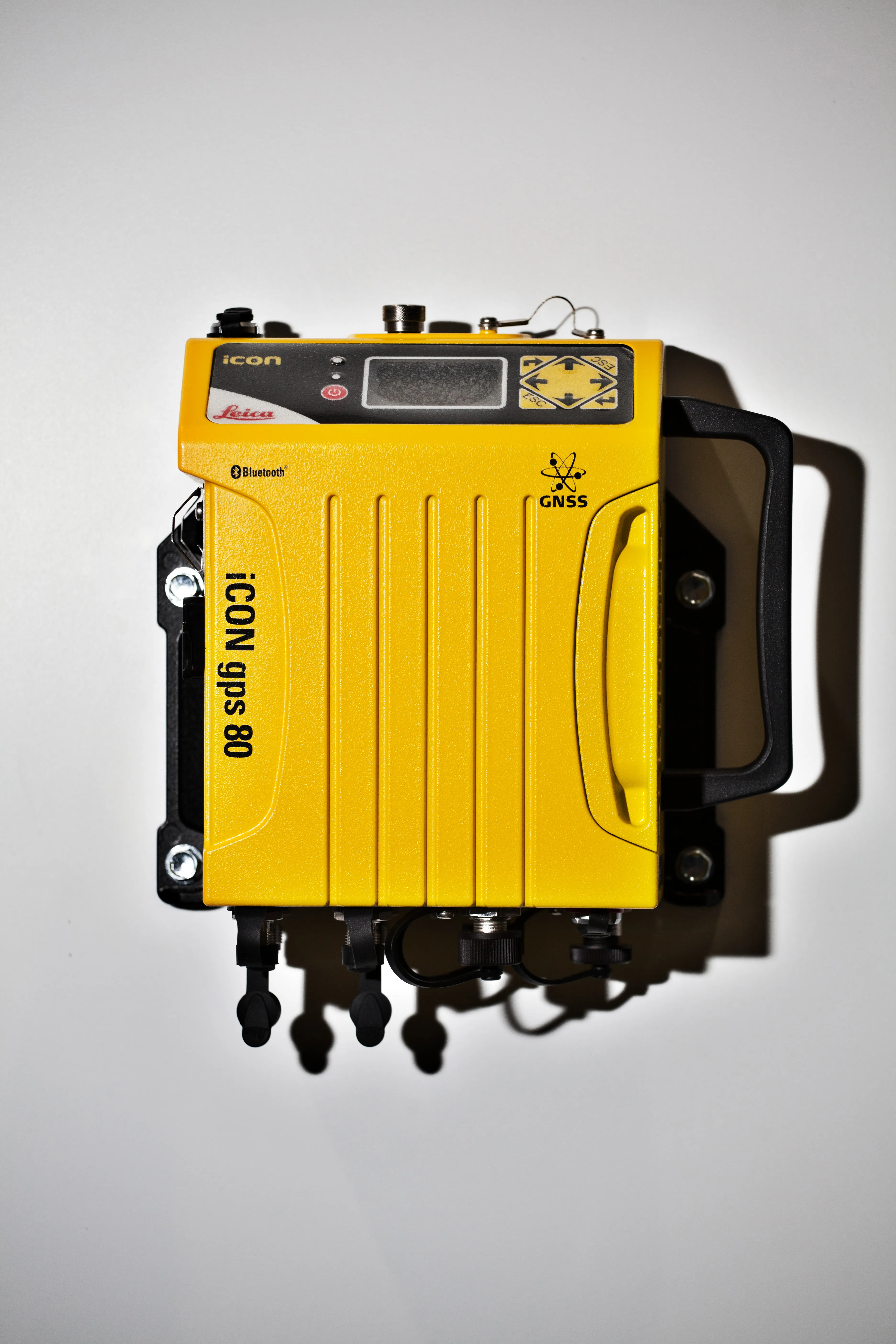
The 265 Leica iCON gps 80 machine control receiver is a compact and rugged GNSS receiver especially developed for a wide range of machine control applications to increase the overall positioning performance on all construction equipment. It easily and safely fits into any construction machine cabin, communicates seamlessly with all iCONtrol solutions on-site and integrates the iCON telematics fleet management software. The flexible communication provides smooth integration with equipment and solutions for OEM partners that require a reliable GNSS position.
Return on the investment of construction equipment depends on machine productivity and uptime, regardless of the application. The robust, accurate and reliable positioning of the new iCON gps 80 GNSS machine receiver helps operators complete jobs faster by saving material and fuel costs in many earth and road work activities.
The future-proof GNSS receiver using xRTK technology is designed to provide accurate positions, even in the harshest environments, and reliable guidance, where none was possible before. The new gps 80 integrates components such as a built-in display requiring no separate controller, a built-in modem and radio requiring no additional radio devices and a robust GNSS-optimised CAN bus system resulting in faster communication between control system and machine. All iCON gps 80 models are extremely compact and fit in any machine cabin quickly and easily. Remote access via the web-based Leica iCON telematics software provides quick data transfer as well as service support thereby increasing machine uptime.
As a new member of the iCONtrol pillar, the iCON gps 80 delivers a flexible solution for on-machine applications using the iCONstruct sensor portfolio, allowing reliable and seamless sensor communication, streamlined workflows and data handling. In addition, the sensor can be used as a GPS base station to provide reliable GPS correction data.
%$Linker:2 Asset <?xml version="1.0" encoding="utf-16"?><dictionary /> 2 12730 0 oLinkExternal www.Leica-Geosystems.com Leica web false /EasySiteWeb/GatewayLink.aspx?alId=12730 false false %>
Return on the investment of construction equipment depends on machine productivity and uptime, regardless of the application. The robust, accurate and reliable positioning of the new iCON gps 80 GNSS machine receiver helps operators complete jobs faster by saving material and fuel costs in many earth and road work activities.
The future-proof GNSS receiver using xRTK technology is designed to provide accurate positions, even in the harshest environments, and reliable guidance, where none was possible before. The new gps 80 integrates components such as a built-in display requiring no separate controller, a built-in modem and radio requiring no additional radio devices and a robust GNSS-optimised CAN bus system resulting in faster communication between control system and machine. All iCON gps 80 models are extremely compact and fit in any machine cabin quickly and easily. Remote access via the web-based Leica iCON telematics software provides quick data transfer as well as service support thereby increasing machine uptime.
As a new member of the iCONtrol pillar, the iCON gps 80 delivers a flexible solution for on-machine applications using the iCONstruct sensor portfolio, allowing reliable and seamless sensor communication, streamlined workflows and data handling. In addition, the sensor can be used as a GPS base station to provide reliable GPS correction data.
%$Linker: