Hexagon continues to develop its software portfolio with the acquisition of Listech, which will compliment its array of construction solutions and particularly those of its Leica Geosystems subsidiary. Listech offers software solutions that aid with data processing and help streamline workflows in land management, construction and engineering projects.
January 6, 2017
Read time: 1 min
7121 Hexagon continues to develop its software portfolio with the acquisition of Listech, which will compliment its array of construction solutions and particularly those of its 265 Leica Geosystems subsidiary. 7122 Listech offers software solutions that aid with data processing and help streamline workflows in land management, construction and engineering projects. The LISCAD portfolio offers a comprehensive set of modules that interface with all major surveying, engineering and CAD systems. The array gives on-site personnel access to sophisticated tools for use in real-time surveying and stakeout. This technology can help optimise measuring, mapping, and recording the physical environment, while reducing the risk of mistakes. The company claims it provides an important tool that ensures proven practices can be combined with high-tech capabilities in an array of applications from road construction to land surveying services.
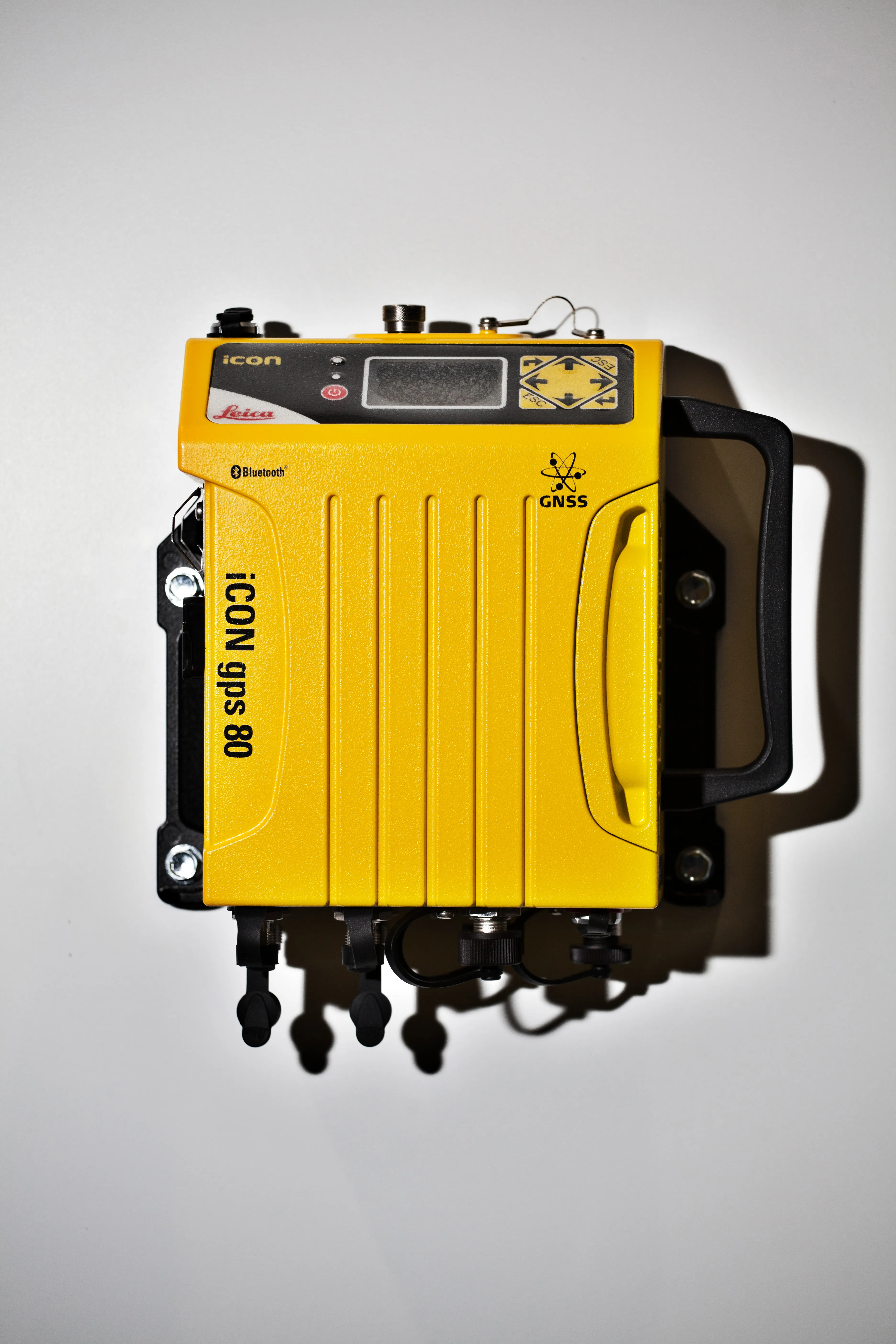
The Leica iCON gps 80 machine control receiver is a compact and rugged GNSS receiver especially developed for a wide range of machine control applications to increase the overall positioning performance on all construction equipment. It easily and safely fits into any construction machine cabin, communicates seamlessly with all iCONtrol solutions on-site and integrates the iCON telematics fleet management software. The flexible communication provides smooth integration with equipment and solutions for OEM p
The Leica iCON gps 80 machine control receiver is a compact and rugged GNSS receiver especially developed for a wide range of machine control applications to increase the overall positioning performance on all construction equipment. It easily and safely fits into any construction machine cabin, communicates seamlessly with all iCONtrol solutions on-site and integrates the iCON telematics fleet management software. The flexible communication provides smooth integration with equipment and solutions for OEM p
U.S. telematics giant Trimble has acquired a suite of software solutions from Penmap.com of Bradford, England.
Penmap.com’s solutions include both office and field data collection software specifically designed for the cadastral and surveying markets. The acquisition enables Trimble to further cater for local application requirements and customer needs by providing complete customised surveying software solutions for the cadastral market.