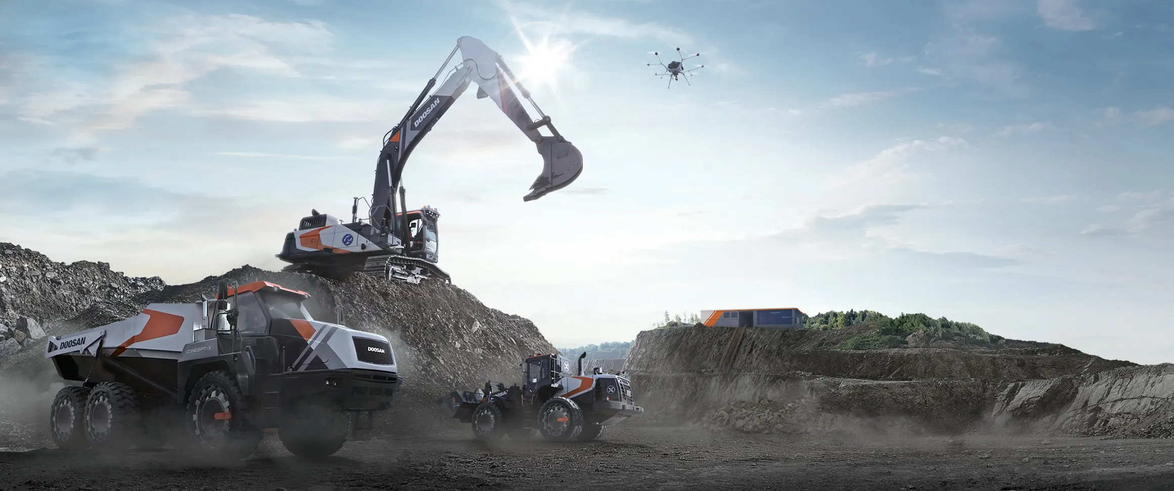
The construction equipment provider says XiteCloud is the first step towards the commercialisation of Concept-X, the company's integrated unmanned and automated control solution, first unveiled in 2019.
XiteCloud is designed to maximise productivity by incorporating complex 3D drone construction surveys and earthwork calculations into a cloud platform, allowing them to be completed in one to two days. Following the launch in South Korea, Doosan Infracore intends to roll out XiteCloud in international markets including Europe in the near future.
The company says the rollout of XiteCloud will enable it to further expand its business portfolio into the field of construction site management, to complement its existing operations in manufacturing and sales of construction equipment.
XiteCloud is designed to enable a contractor to manage multiple tasks such as surveys, terrain analysis, equipment operation and construction management on a single platform, thereby reducing construction costs and saving time while increasing work accuracy, which in turn raises productivity.
The solution can digitise earthwork site information into three dimensions and can also analyse rock formations. Since XiteCloud is cloud-based, Doosan Infracore says this makes it easy for stakeholders, including contractors and clients, to join forces and manage the progress of a given project together.
Even on unfriendly terrain such as steep slopes and cliffs, XiteCloud calculates exact work volumes using advanced drone-based surveys. By analysing vast amounts of field data quickly and accurately, XiteCloud completes construction surveys and earthwork calculations, which typically take as long as two weeks, within a day or two.
At one urban redevelopment site in a metropolitan area, the XiteCloud platform analysed and calculated the work volume of rock formations that were discovered only after the project had kicked off, thus enabling the client and the contractor to reach an agreement on adjusting the construction period. The visualised 3D data enabled them to come to an agreement about additional construction costs as well as the extension of the construction period.
"Concept-X is a comprehensive control solution that encompasses the entire construction process, including drone-based surveys, automatic analysis of topographical data, construction planning, and unmanned construction machinery and control centre operations," said an executive of Doosan Infracore. "We will launch various solutions in stages even before the full-scale commercialisation of Concept-X, with the launch of XiteCloud marking the very first step towards that goal."