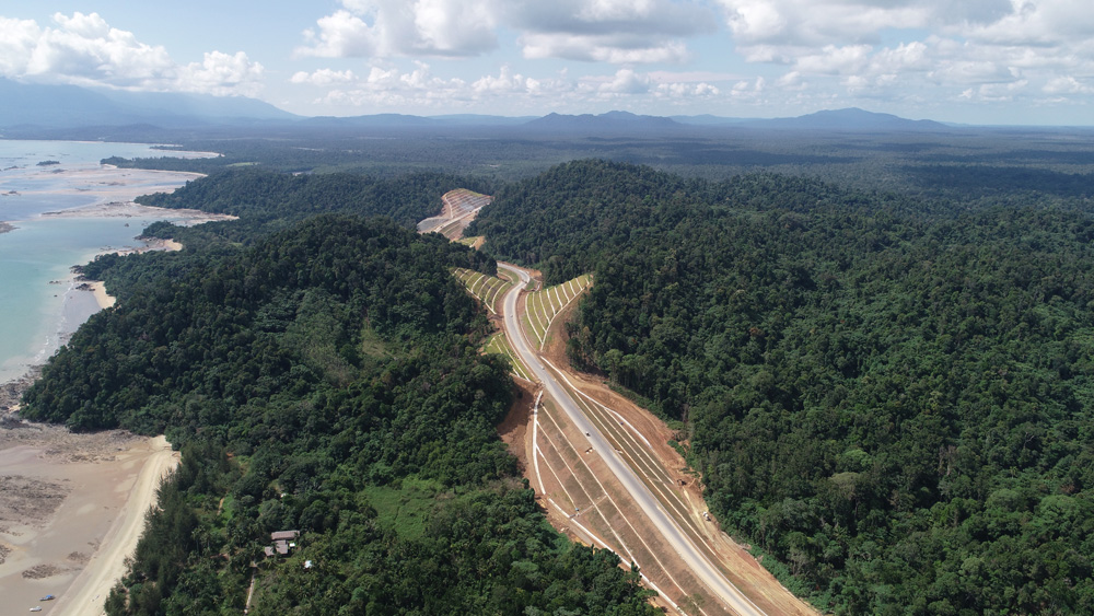
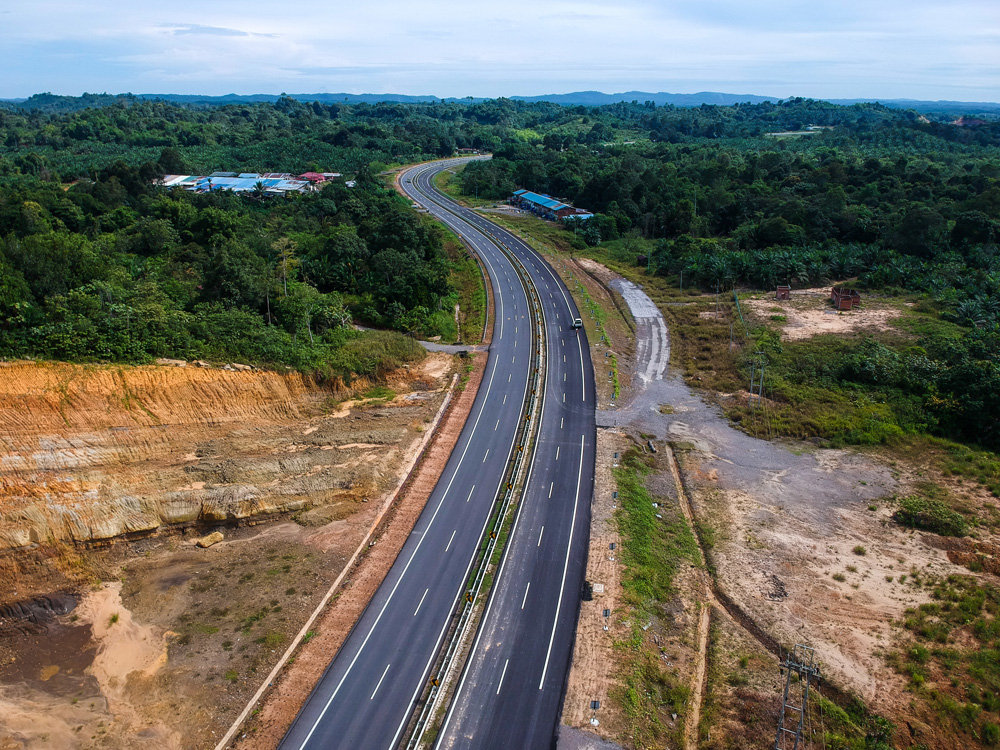
Located on the island of Borneo, the new toll-free expressway is the Pan Borneo Highway. The highway stretches 1,060km through undulating, rainforest terrain and protected reserves between Telok Melano and Merapok. Construction began in 2015 and when fully completed in 2021 the Pan Borneo Highway will be the state’s transportation backbone, playing a major role in opening economic corridors and opportunities for residents and local businesses.
Development of phase one of the MYR 16.15 billion (US$3.71 billion) government-funded roadway initiative involved constructing a four-lane dual carriageway over a length of 786km. Lebuhraya Borneo Utara (LBU) is the project delivery partner on this project, facilitating lifecycle digitalisation to meet strictly imposed government requirements. LBU selected Reveron Consulting, a Bentley Channel Partner, to implement Bentley solutions for design, construction, and operations of the Pan Borneo Highway.
Throughout design, planning, and construction, LBU initiated BIM workflows for the first time on a Malaysian road and highway project. The team used ProjectWise to create an open, connected data environment to support the implementation and integration of BIM, GIS, and reality modeling processes. Now, LBU is responsible for expanding the application of BIM and big data, leveraging design models and construction information to establish a digital platform to manage operations and maintenance. As the largest infrastructure project in Sarawak, its pioneering digital methodologies means that the Pan Borneo Highway serves as a benchmark, capitalising on BIM and advanced technology strategies for more efficient delivery and optimal asset performance.
Developing a Sustainable Technology Solution
LBU digitalised planning, design, and construction of the Pan Borneo Highway, accommodating government standards to deliver best value while retaining and training local contractors and resources to build expertise using advanced technology for construction. Having leveraged Bentley applications throughout construction, including for construction monitoring, the next phase focused on operations, maintenance, and asset management to ensure the highway meets its current and future functional requirements. “We had to look at a sustainable solution 30 to 40 years down the line to ensure a reliable backbone for transportation infrastructure within the state, for the people, and needed a system that best fit within our digital architecture. AssetWise did that,” said Ravi Koka, chief executive officer, Reveron Consulting.
Effective asset management starts with knowing where all the assets are located along the infrastructure. Using AssetWise, LBU integrated BIM information within GIS applications to produce highway information modeling for the entire 786km of phase one. With the first work package spanning 32.8km from Telok Melano to Sematan already complete, the team used the Bentley-based integrated highway management system to provide the government with verification of each roadway asset, including inventory, location, condition, and defect management along its length. Bentley’s asset performance and management technology serves as a reliable platform to help LBU better plan for the operation and maintenance of the Pan Borneo Highway. With real-time visibility into asset status, easily accessible to the entire project team and government stakeholders, AssetWise provides a single source of truth for all asset data, facilitating an efficient and sustainable solution to optimise highway operations.
Leveraging Bentley’s Connected Data Environment for Asset Management
During the phase-one delivery stage, LBU used ProjectWise to establish a connected data environment, which was used to manage the design and construction data generated on the project, enabling teams to simultaneously access and work on information from various sources. It also facilitated early clash detection and resolution that helped avoid unnecessary rework and simplified construction management. Having already established the connected data environment with ProjectWise, LBU introduced Bentley’s AssetWise enabling the team to link the valuable design and construction information with asset tags to track and manage change throughout project delivery.
Starting with the completed 32km span in January 2019, LBU began integrating construction data from ProjectWise into AssetWise for its ongoing operations and maintenance. Providing seamless integration with a connected data environment that spans project delivery and operations unlocks the full potential of the organisation’s digital data
Digital Twins Key to Efficiency
In addition to seamlessly integrating design and construction information for asset management on the highway, LBU is also using ContextCapture to incorporate the reality context for lengths of existing roads on a highway network built over the last 10 to 15 years. Leveraging images captured using unmanned aerial vehicles, LBU has built an accurate record of asset information for the entire 1,060km Pan Borneo Highway. Capitalising on reality modeling, as well as digital processes and workflows that are already implemented within the connected data environment, LBU is using contextual information and a digital twin approach as the basis for operational decisions. Bentley’s integrated applications along with its connected data environment provide a complete technology solution that enables the creation of a digital twin.
With AssetWise at its core, a digital twin provides a single reliable source of asset information necessary to support ongoing asset performance and management. LBU’s digital twin uses Bentley technology to combine BIM, reality modeling, and GIS data to provide immersive visibility and analytics for timely decision-making and improved infrastructure asset performance. The digital twin integrates a road information system, a bridge management system, and a maintenance management system that are specifically developed and designed to include development of nonconformance reports. The road information system also includes a cyclical work program and customised interim payment certificate for managing work orders. It also includes a web-based GIS, mobile-based field data collection for inventory of assets and their conditions, a pavement management system in conjunction with HDM-4, together with real-time dashboards and reporting.
LBU engineers, maintenance and management teams, and government stakeholders have access to reports, dashboards, and performance data via a dynamic digital twin to ensure safety, reliability, and efficiency. Leveraging Bentley’s connected data environment, including ProjectWise and AssetWise, to create and maintain its digital twin is key to driving LBU’s entire digital framework for managing data, building the asset, integrating visualising all information in a dashboard for the government to monitor and ensure LBU meets its commitments.
Digitalization Promotes Industry Success
The Pan Borneo Highway is not just another infrastructure initiative; it is a technology advancement that is promoting digitalisation efforts to expand opportunities within the roadway industry beyond Malaysia. LBU is encouraging and training future local engineers and designers to use BIM and digital technology for infrastructure. The organisation is playing a significant role driving economic opportunities in East Malaysia using digitalisation, leveraging Bentley’s asset performance and management technology within a connected data environment, to benefit the public and promote industry success.
“Using BIM across the asset lifecycle of the Pan Borneo Highway Sarawak readies this transportation backbone for more digital applications to be used, such as Internet of Things (IoT) and big data, to better manage future traffic flows, and contribute to a balanced economic development for Sarawak,” stated Nor Zalida Ahmad, head of communications at LBU. With such potential, a digital twin can be used to determine traffic patterns and where people are moving to help balance economic and social developments, ensuring that the state’s continued good progress. As the benchmark for government road projects in Malaysia, providing increased efficiency and cost-effective processes using digital workflows, the Pan Borneo Highway is setting the stage for future highway operations, maintenance, and asset management.
Click here to learn more
Sponsored content produced in association with Bentley