Revolutionary cable locator

Leica Geosystems says its new Leica Digicat 600i and 650i series, with Logicat software, is set to revolutionise underground cable location. The 600i and 650i, fitted with what Leica says is an innovative data capture and on-board memory function, is said to aid operations management moves to increase onsite safety by detecting cables and identifying operator training needs. Locating underground cables and pipes is said to be a simple and efficient task with the 600i and 650i series, boosting the operator’s
June 19, 2012 Read time: 2 mins
Leica Geosystems says its new Leica Digicat 600i and 650i series is set to ‘revolutionise’ underground cable location
265 Leica Geosystems says its new Leica Digicat 600i and 650i series, with Logicat software, is set to revolutionise underground cable location.

The 600i and 650i, fitted with what Leica says is an innovative data capture and on-board memory function, is said to aid operations management moves to increase onsite safety by detecting cables and identifying operator training needs. Locating underground cables and pipes is said to be a simple and efficient task with the 600i and 650i series, boosting the operator’s productivity and profitability.

The 650i is said to offer the user the same features and functionally of the 600i, with the extra benefit of service depth indication.

When using the Digicat in conjunction with the Digitex 100t or Sonde in 8 or 33 kHz modes, operators can determine the depth of the buried utility which, according to Leica, provides a clear advantage when conducting ground surveys.

The 600i and 650i locators have Bluetooth wireless connectivity, allowing the Digicat to integrate with mobile mapping technology to log survey data, in addition to enabling wireless Bluetooth data transfer. With Logicat software, calculation records can be retrieved and collated, helping to improve onsite safety and identify training needs.

For more information on companies in this article

Related Content

  • Location location
    February 28, 2012
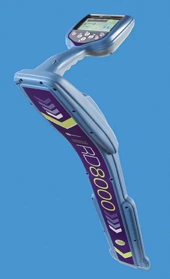
    Improved underground utility location capabilities are claimed for the improved unit from Radiodetection, This new unit is a development of the RD8000 range of pipe and cable locators introduced by Radiodetection in 2008 and offers the addition of an innovative current direction (CD) feature. This is available on Radiodetection's most advanced locator the RD8000PDL and allows a user to trace and identify a target cable in highly congested areas or when running parallel to other lines.
  • Compaction review: cutting edge updates
    June 21, 2024
    An array of innovative asphalt compaction machines are now coming to market from several of the major manufacturers.
  • Leica believes that digitisation is the key to improving efficiency and lowering costs
    April 20, 2016
    The digitisation of the construction process will give greater transparency on costs at the site and ultimately lead to improved productivity and efficiency in the industry, said Johan Arnberg, president of Leica Geosystems Machine Control Division, speaking at a Leica roundtable on digitisation of the construction industry held at bauma. The data gathered by the new generation of digitised construction machines and tools will enable contractors and owners for the first time to put key performance indicator
  • Using radar to deliver a fine runway finish
    April 4, 2014
    Radar Portal Systems (RPS) has spent a lot of time developing its sophisticated pavement top-surface photometric imaging system so it can cater specifically for the aviation market. This has now been specially developed for use on aircraft runways and taxiways The system was recently used at Brisbane Airport to survey runway and runway shoulders, collecting photometric top-surface data at a 4m width at speeds of up to 100km/h. This dataset allows the firm to display meshing data of the runway surface showin