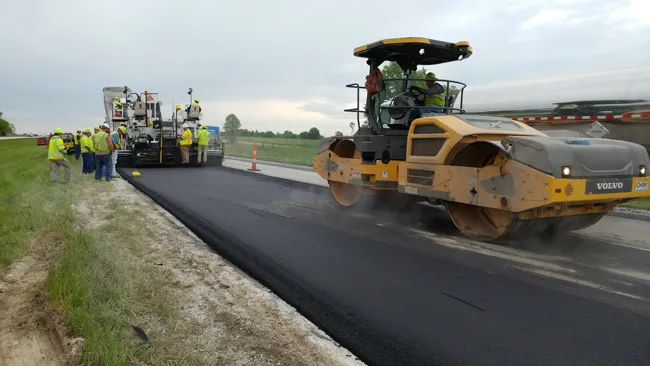
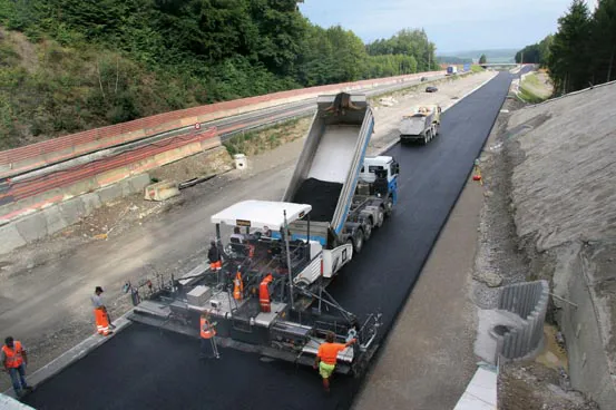
Widening the busy A4 road in Switzerland to four lanes was achieved quickly by using the latest paving technology. Increased traffic required the widening of the A4 from two to four lanes along a 20km section, with two lanes separated by a central divider in each direction. Carrying 20,000-25,000 vehicles/day, the trunk road between Winterthur and Schaffhausen was one of Switzerland's busiest two-lane stretches, and as a result, the Federal Council of Switzerland in Bern planned an enlargement of the dual-l
Widening the busy A4 road in Switzerland to four lanes was achieved quickly by using the latest paving technology.
Increased traffic required the widening of the A4 from two to four lanes along a 20km section, with two lanes separated by a central divider in each direction.
Carrying 20,000-25,000 vehicles/day, the trunk road between Winterthur and Schaffhausen was one of Switzerland's busiest two-lane stretches, and as a result, the Federal Council of Switzerland in Bern planned an enlargement of the dual-lane A4 trunk road to the Swiss four-lane mini-motorway requirement. These mini-highways, for instance, feature narrower carriageways and do not have hard shoulders for their whole length.
Swiss contractor2552 Implenia used a 1194 Vögele SUPER 2100-2 paver equipped with the firm's sophisticated Navitronic Plus 3D control system and this helped speed the work and deliver the accuracy required. The contractor's paving crew was working with the Navitronic Plus system for the first time and the job in hand was to place the foundation layer and base course for the new lanes on the basis of a 3D model, without using physical reference lines.
For the A4, a hot-mixed foundation course was placed with a share of recycled asphalt ranging from 50-60%. On this job the Navitronic Plus system used sophisticated positioning equipment from Leica Geosystems. Based on the route's digital design data, this technology picks up the paver's actual position by a total station and a 360° prism. High-precision sensors on the paver supplied extra information on the screed's elevation and slope as well as the screed's position. The data was then passed onto the positioning system's external computer and a comparison was made with the route's stored design data. Any deviations detected were transmitted to the Navitronic Plus package to make the necessary corrections.
Tolerance requirements were met from the start. Despite using the system for the first time, the paving crew was able to meet the specified tolerance requirements of +/-4mm, placing the foundation layer and base course in a large width up to 9m without the need for tensioned guide wires.
Increased traffic required the widening of the A4 from two to four lanes along a 20km section, with two lanes separated by a central divider in each direction.
Carrying 20,000-25,000 vehicles/day, the trunk road between Winterthur and Schaffhausen was one of Switzerland's busiest two-lane stretches, and as a result, the Federal Council of Switzerland in Bern planned an enlargement of the dual-lane A4 trunk road to the Swiss four-lane mini-motorway requirement. These mini-highways, for instance, feature narrower carriageways and do not have hard shoulders for their whole length.
Swiss contractor
For the A4, a hot-mixed foundation course was placed with a share of recycled asphalt ranging from 50-60%. On this job the Navitronic Plus system used sophisticated positioning equipment from Leica Geosystems. Based on the route's digital design data, this technology picks up the paver's actual position by a total station and a 360° prism. High-precision sensors on the paver supplied extra information on the screed's elevation and slope as well as the screed's position. The data was then passed onto the positioning system's external computer and a comparison was made with the route's stored design data. Any deviations detected were transmitted to the Navitronic Plus package to make the necessary corrections.
Tolerance requirements were met from the start. Despite using the system for the first time, the paving crew was able to meet the specified tolerance requirements of +/-4mm, placing the foundation layer and base course in a large width up to 9m without the need for tensioned guide wires.