Sophisticated geopositioning tool from Topcon

Topcon says that its new T-18 handheld controller offers accuracy for geopositioning, construction, mapping and vertical construction applications. The controller includes a sunlight-readable display with a 1GHz processor, 1GB of internal storage, and up to 10 hours of battery life. “For MAGNET Field data collection, the T-18 controller offers a durable ergonomic solution with faster processing, a larger screen, better connectivity and longer battery life than previously available comparable systems,” said
October 9, 2018 Read time: 2 mins
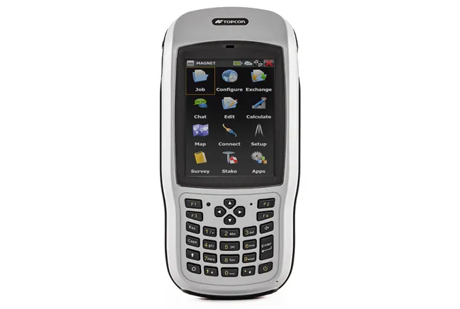
Topcon’s new T-18 unit offers advanced geopositioning capabilities
342 Topcon says that its new T-18 handheld controller offers accuracy for geopositioning, construction, mapping and vertical construction applications.  The controller includes a sunlight-readable display with a 1GHz processor, 1GB of internal storage, and up to 10 hours of battery life. “For MAGNET Field data collection, the T-18 controller offers a durable ergonomic solution with faster processing, a larger screen, better connectivity and longer battery life than previously available comparable systems,” said Ray Kerwin, director of global surveying products.


The T-18 features a 3.5G cellular modem for connectivity with Topcon MAGNET solutions for sending and receiving data to the cloud company account.  The firm says that the cellular option makes it easier to communicate with field crews when projects need to be changed or if important data is required back in the office. The modem can be used for RTK correction services. Additional key features include standard Bluetooth and Wi-Fi connectivity, as well as an IP65 rating for dust and water protection in demanding job site conditions.

For more information on companies in this article

Related Content

  • IBI’s Routemapper charts new territory with Highways England
    September 14, 2016
    Mapping the asset High-speed data collection just got faster for England’s newly created strategic roads operator Highways England’s establishment as a publicly held company in 2015 created a need for a highly accurate asset inventory. This was potentially very costly and had serious safety implications. As well as its relationships with numerous managing agents and contractors, assets include 35,300km of highway, 12,100km of earthworks, 23,200km of safety fences, 150,000 technology assets and sig
  • Accuracy from Sandvik’s WX6500 screening media
    April 13, 2018
    NCC Industry in Södra Sandby, Sweden has been using Sandvik’s latest screening media technology, the WX6500, for over a year The company reports that the first fine screening test panels are still in place and performing reliably. NCC Industry's Stone Materials division said that it has long chosen rubber screening media over wire mesh. The choice is crucial in Södra Sandby, where abrasive quartzite produces excessive wear on metal components. Yet despite its preference, the company said that it had stru
  • Sullair unveils 400, 1600 cubic foot per minute air compressors
    March 8, 2017
    Sullair introduced new large and small portable compressed air units at CONEXPO-CON/AGG. The 1600H has a Tier 4 Final engine to give a compression rating of 1600 cubic foot per minute (CFM) at 100 to 150 pounds per square inch (psi).
  • It’s a level playing field with Leica’s iCON gps 70 Series
    April 27, 2018
    Efficiency is the name of the game from the iCON gps 70 Series, a GNSS rover from Leica Geosystems. With the iCON gps 70 T you can measure and stakeout points faster and without the need to keep the pole vertical and level the bubble. The combination of the latest GNSS technology and inertial measurement unit (IMU) equips the iCON gps 70 T with permanent tilt compensation and makes it resistant to any magnetic interference. Because the iCON gps 70 T is calibration-free, it can be ready instantly and any