Sophisticated geopositioning tool from Topcon

Topcon says that its new T-18 handheld controller offers accuracy for geopositioning, construction, mapping and vertical construction applications. The controller includes a sunlight-readable display with a 1GHz processor, 1GB of internal storage, and up to 10 hours of battery life. “For MAGNET Field data collection, the T-18 controller offers a durable ergonomic solution with faster processing, a larger screen, better connectivity and longer battery life than previously available comparable systems,” said
October 9, 2018 Read time: 2 mins
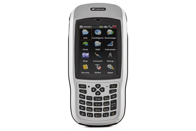
Topcon’s new T-18 unit offers advanced geopositioning capabilities
342 Topcon says that its new T-18 handheld controller offers accuracy for geopositioning, construction, mapping and vertical construction applications.  The controller includes a sunlight-readable display with a 1GHz processor, 1GB of internal storage, and up to 10 hours of battery life. “For MAGNET Field data collection, the T-18 controller offers a durable ergonomic solution with faster processing, a larger screen, better connectivity and longer battery life than previously available comparable systems,” said Ray Kerwin, director of global surveying products.


The T-18 features a 3.5G cellular modem for connectivity with Topcon MAGNET solutions for sending and receiving data to the cloud company account.  The firm says that the cellular option makes it easier to communicate with field crews when projects need to be changed or if important data is required back in the office. The modem can be used for RTK correction services. Additional key features include standard Bluetooth and Wi-Fi connectivity, as well as an IP65 rating for dust and water protection in demanding job site conditions.

For more information on companies in this article

Related Content

  • New demolition excavators
    April 29, 2025
    Extended reach excavators offers versatility for demolition works, with new models now available
  • LiDAR surveying is making inroads into asset management
    December 18, 2017
    In the coming age of the autonomous vehicle, fast and accurate LiDAR surveying will be increasingly important, explains Valdis Vanags. The game-changing introduction of autonomous vehicles relies not only on intelligent traffic systems but well maintained roads to help computer-guided systems navigate using road markings. Laser scanning technology, too, is a game changer when it comes to planning and executing many civil engineering projects, including transport network upgrades and smart city initiatives.
  • Topcon expanding through acquisition
    April 30, 2018
    Topcon Positioning Group is expanding its portfolio with the acquisition of Viasys VDC, a Finnish infrastructure construction software development company. The purchase is intended to strengthen Topcon’s software development expertise. This will support delivery of advanced Topcon virtual design and construction solutions with BIM interoperability. Topcon has now acquired all the outstanding shares of Viasys VDC after having bought a significant percentage of its holdings in early 2016. Jason Hallett, VP of
  • Bentley is building its software solutions portfolio
    May 14, 2015
    Bentley Systems continues to develop its portfolio of software solutions - Mike Woof writes One of the leaders in the field of construction software, Bentley Systems is developing its array of solutions for industry users. The company is growing both by acquisition and organically, using its financial strength to buy up smaller niche firms as well as developing the capabilities of its in-house software further. The company has recently made three key acquisitions, for EADOC, Acute3D and C3global. The