Monitoring field activities accurately

Boschung says that its bMoves tool is a novel digital solution for managing field services.
March 14, 2022 Read time: 1 min
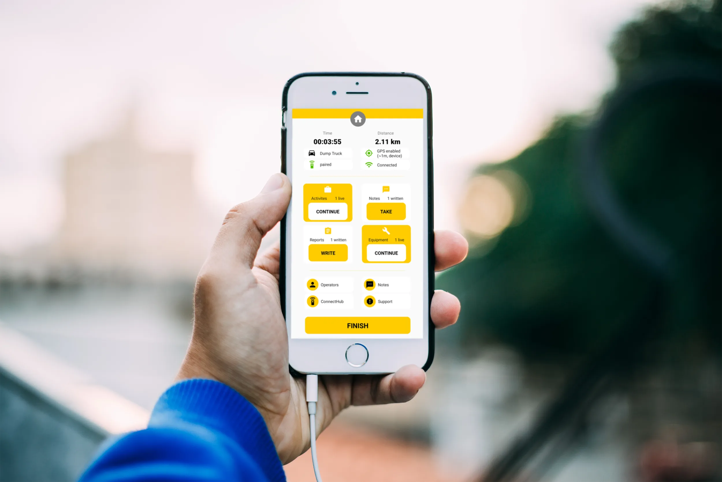
Using the bMoves app, interventions from each operator are displayed in real time on a phone, tablet or computer

With its intuitive design, bMoves allows maintenance departments of roads, airports and municipalities to improve field activity monitoring. Boschung says its innovative solution can support organisations in analytical and decision-making work.

Designed to ease the workload for maintenance departments, bMoves features tools to improve field services, onsite reporting and fleet management.

With the bMoves app, everything an operator does in the field is accurately recorded and located. The bMoves app for Android and iOS, features an easy-to use interface for efficient and reliable data acquisition. It can connect wirelessly to any vehicle and retrieve data, such as route or equipment usage.

Related Content

  • Versatile traffic camera to boost safety
    August 14, 2017
    Siqura is offering the TrafficPTZ Ultimo, a Pan Tilt Zoom camera that is said to be optimised to meet traffic and infrastructure demands. A nove feature is the embedded processing, which allows third party application software such as analytics to run on it. The unit is claimed to be an all-IP camera with a robust design that features fast and accurate positioning. It also has no backlash, a large zoom lens and is easy to install. The camera responds automatically to information from roadside sensors such a
  • Drivewyze: US e-inspections on the rise
    February 18, 2022
    Drivewyze says that its weigh station programme is in a phase-one deployment that expedites CSA-crediting Level III inspections in station in the US.
  • Developments in bridge monitoring technology
    July 9, 2012
    Advances in bridge monitoring technology should help ensure structural safety Highly productive, Fugro Aperio's ground penetrating radar system offers accurate scanning of bridge condition Bridge engineers can now benefit from a new technology designed to pinpoint shallow targets, such as masonry fixings, reinforcement bars or delamination between thin layers. This uses the latest high resolution ground penetrating radar (GPR) antenna and has been developed by Cambridge-based Fugro Aperio in the UK. Operati
  • Topcon’s LN-100 3D positioning system
    May 13, 2014
    Topcon Positioning Group says its new BIM solution - the LN-100 – is the world’s first 3D positioning system designed specifically for construction layout. Said to offer seamless integration and flow of project data from the design to the field, the LN-100 is simple to operate, removing “the intimidation factor and reducing the learning curve in performing construction layout tasks,” according to Eduardo Falcon, Topcon Positioning Group executive vice president and general manager for the GeoPositioning