Efficient construction management with B2W

The firm is introducing an updated version of B2W Schedule with new capabilities for scheduling, dispatching and tracking construction materials. It is also offering significant field log user experience upgrades to B2W Track, the company’s field tracking and analysis software. In addition, the firm has a new B2W Inform app, which allows contractors to use the B2W forms and reporting solution without internet connectivity. B2W CEO and founder Paul McKeon said, “We completed important updates across our
July 3, 2019 Read time: 2 mins
B2W Software is now offering key product developments to its unified ONE Platform.


The firm is introducing an updated version of B2W Schedule with new capabilities for scheduling, dispatching and tracking construction materials. It is also offering significant field log user experience upgrades to B2W Track, the company’s field tracking and analysis software. In addition, the firm has a new B2W Inform app, which allows contractors to use the B2W forms and reporting solution without internet connectivity.

B2W CEO and founder Paul McKeon said, “We completed important updates across our estimating, field tracking and equipment maintenance elements and invested to keep the ONE Platform technologically current.”

The new materials management capabilities within B2W Schedule enable contractors to schedule and dispatch materials – in addition to employees, crews and equipment. They can also track quantities and locations of materials across their sites. B2W Schedule centralises resource planning, scheduling and dispatching processes and moves them online to allow real-time collaboration. Users across workflows can view and assign resources on desktop or mobile devices based on their areas of responsibility.

McKeon highlighted expanded browser compatibility and many time-saving user experience improvements to B2W Track, which drew positive reviews from attendees. “We’ve made it faster and easier to create and complete field logs and enhanced how B2W Track users can copy values from previous logs, catch potential errors and reconcile data from field logs with their accounting systems,” he added.

The new B2W Inform app benefits contractors that work in remote locations or other situations where they are unable to connect to the internet.

Electronic forms for safety, inspections, training and other use cases can be downloaded in advance to any mobile device, and the completed forms synch back with B2W Inform for distribution and reporting when a connection is established.

Cloud-based B2W Inform generates reports, dashboards and alerts from electronic forms.

Fast, easy creation and management of customised forms – including a user-ready template library -- enables contractors to replace paper-based processes and capture rich data in real time.

Related Content

  • It's all about profit, people and the planet
    February 18, 2025
    Sit in on our latest roundtable discussion on sustainability in the construction and aggregates industries, brought to you by Global Highways and Aggregates Business. AB editor Guy Woodford has been talking to two world-class experts: Jeremy Harsin from Cummins and Michael Gomes from Topcon. Make your planning, your workflows, your contract tenders, and your sites as sustainable as possible. “Sustainability is really about profit, people and the planet,” say our experts. “Being able to drive that is the work that matters.”
  • Proper GPR Surveying Techniques
    May 10, 2019
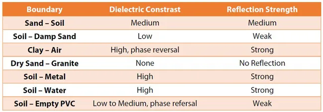
    A sustainably good road surface often depends on how well understood is the ground underneath the road’s route. Brian Jones* offers some best practice and advice for getting the most from ground-penetrating radar investigations Ground-penetrating radar (GPR) is one of the most accurate non-destructive testing (NDT) methods available. To get the most from GPR surveying, it is absolutely essential to understand how GPR tools work and follow best practices when conducting surveys. Key areas to be aware o
  • Improved survey data handling
    August 2, 2012
    Leica Geosystems says that its Leica MobileMatriX v3.0 package can be used to synchronise survey data with an enterprise geodatabase, transfer digital images taken from a mobile phone via Bluetooth and link it with a feature, in addition to many other improvements. The firms says that its MobileMatriX v3.0 package offers a flexible and powerful mobile GIS application and can be used in both large projects and small projects involving only a few field crews. Survey data can be replicated within the editing p
  • Paris traffic management for PTV
    September 25, 2023
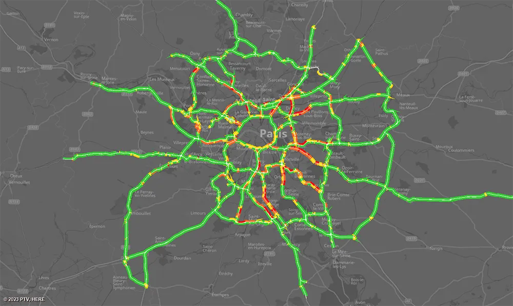
    The Paris region highway authority has adopted PTV technology, including PTV Flows, to enhance traffic management such as live traffic updates.