An array of new software and hardware tools are coming to market that can boost working efficiency for construction projects. Technology company thinkWhere is helping to improve collaboration and communication on Scotland’s largest road infrastructure project. Providing online access to multiple layers of live project maps and geographical data, the firm’s groundMapper software offers a web-based viewer that is allowing the construction team for the Aberdeen Western Peripheral Route to access up to date constraint maps saving valuable time and money.
“Due to the extensive area affected by the project and the vast array of datasets available, we needed a solution that would allow us to effectively access, share and communicate geographically referenced information in real time,” commented Angela Gardner, environmental manager for the AWPR Construction Joint Venture.
Developed by thinkWhere groundMapper is an online Geographical Information System (GIS) viewer that brings together location based data. The tool allows users to search for and view multiple datasets and is hosted on a dedicated website, providing data such as aerial photographs, private water supplies, ecological features, blasting areas and site office locations. These can be overlaid on the basic route layout while users can search the online datasets by postcode, drawing sheet reference, chainage or structure to get an overview of key project features.
The AWPR B-T Construction, estimated at £550 million, will see the construction of 54km of dual carriageway around the city of Aberdeen. Designed to create an alternative route from north to south Aberdeen, construction is expected to be completed in 2018.
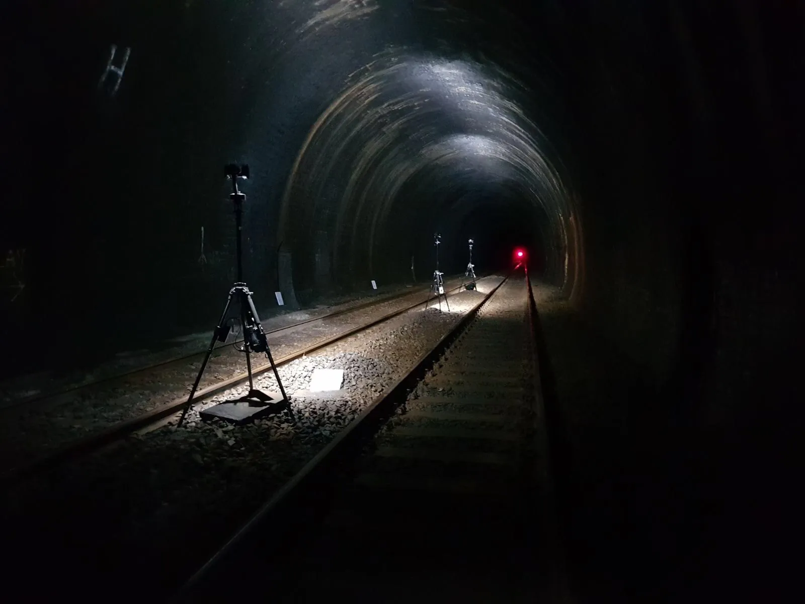
Meanwhile for underground use, L&M Survey Services has carried out a full inspection survey of a 1km working tunnel in the East Midlands using its advanced new 32-bit High Dynamic Range (HDR) SceneCam camera and ScanLight lighting system.
The work was completed by a two-person team over three nights, minimising disruption to the client, providing high-quality inspection survey information to any authorised PC.
L&M’s Spheron SceneCam solution was chosen for the job due to its 32-bit High Dynamic Range (HDR) camera and battery powered ScanLight lighting system, which enabled capture of all the detail present despite the complete darkness.
The company’s HDR technology can be used to manipulate and store colours and brightness levels, which is said to provide high visibility. Unlike conventional digital photography, this system does not require an extra light source. However, L&M says its HDR SceneCam cameras offer high-precision detail of brightness and colour information, avoiding loss of colour vision in dim conditions and much higher levels of contrast between different objects, even in complete darkness.
The HDR SceneCam equipment recorded image-pairs every 10m. Three image locations were captured simultaneously and the cameras then moved on to the next three locations. The SceneCam images were supplemented with additional images from a standard frame digital camera.
L&M’s SceneCam camera captured a single, continuous image around a full 360° in the horizontal and 300° in the vertical. No stitching of images was required.
Another major benefit of L&M’s SceneCam technology is that no processing is required and the spherical images are imported directly into Spheron’s own SceneCenter software. Once complete, the data allows the viewer to navigate through the tunnel in a similar way to Street-view. The viewer can increase the brightness, zoom in, open reports and also measure dimensions directly from the images.
BIM approach
Pöyry Deutschland is now a member of the German Chapter of the international organisation buildingSMART. This move allows Pöyry Deutschland to take part in establishing Building Information Modelling (BIM) standards, as buildingSMART is an international network for BIM, is active in 26 countries and aims to develop open global BIM standards.