
MOBA’s new PAVE-IR system features a high-speed temperature scanner to enhance road construction quality

MOBA has developed a new temperature scanner system called the PAVE-IR, designed to help operators avoid laying incorrectly heated asphalt. From mixing plant to compaction, getting the temperature of asphalt right is critical. Cold asphalt can lead to road damage, which results in additional costs of up to 46% due shorter surface lifetimes. The new MOBA PAVE-IR aims for an optimum asphalt material mix and the best possible process flow says the manufacturer.
January 6, 2017 Read time: 2 mins
MOBA’s Marcus Waterman demonstrating what a difference the new PAVE-IR system makes to the operator
1228 MOBA has developed a new temperature scanner system called the PAVE-IR, designed to help operators avoid laying incorrectly heated asphalt.

From mixing plant to compaction, getting the temperature of asphalt right is critical. Cold asphalt can lead to road damage, which results in additional costs of up to 46% due shorter surface lifetimes.

The new MOBA PAVE-IR aims for an optimum asphalt material mix and the best possible process flow says the manufacturer.

The MOBA PAVE-IR uses a new high-speed temperature scanning system to monitor the temperature during asphalt paving and document it for the entire project. As a result, contractors can optimise their processes and verify the quality of the paving process.

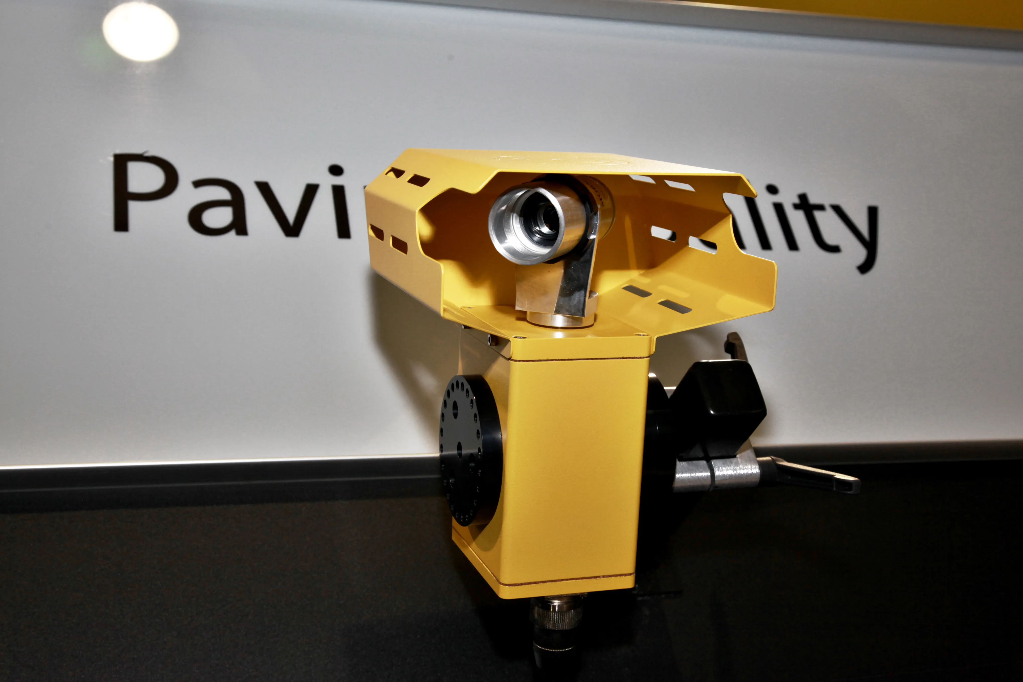
The system uses an intelligent temperature scanner over the entire paving width of up to eight metres to measure the temperature of the asphalt. The measurement width can be set individually.

With up to 31 measurement points, the scanner achieves an accuracy of ± 2°C at typical asphalt temperatures with the temperature profile being displayed in real-time. As a result, the operator can react at any time if irregularities occur.

In addition, the profile is stored with the GPS position data and transferred to a USB stick. In conjunction with the PAVE Project ManagerTM software, the contractor can evaluate and document the data in the office.

Alternatively, the data can be sent via GSM to a server, where it can be called up at any time with a web application.
%$Linker: 2 Asset <?xml version="1.0" encoding="utf-16"?><dictionary /> 2 69175 0 oLinkExternal www.Moba.de MOBA Mobile Automation Web false /EasySiteWeb/GatewayLink.aspx?alId=69175 false false%>

For more information on companies in this article

Related Content

  • AGS demonstrates the power of its new 3D application for the ID4 anti-collision crane safety management system
    January 6, 2017
    Crane and site safety management specialist AGS, which also makes and supplies elevated obstruction lighting , anemometers and anti-collision systems, will use Bauma to demonstrate its new 3D application for the ID4 anti-collision crane management system. AGS has more than 5,000 systems in use on construction sites around the world and it has a long-term strategic partnership agreement with Bouygues Construction. The group will also announce the setting up of three new subsidiaries in Rhône-Alpes, Île-de-Fr
  • AGS demonstrates the power of its new 3D application for the ID4 anti-collision crane safety management system
    March 27, 2013
    Crane and site safety management specialist AGS, which also makes and supplies elevated obstruction lighting , anemometers and anti-collision systems, will use Bauma to demonstrate its new 3D application for the ID4 anti-collision crane management system. AGS has more than 5,000 systems in use on construction sites around the world and it has a long-term strategic partnership agreement with Bouygues Construction. The group will also announce the setting up of three new subsidiaries in Rhône-Alpes, Île-de-Fr
  • Leica’s new Digicat xf-Series cable locators and transmitters
    January 6, 2017
    Leica Geosystems has launched the latest editions to the Digisystem product range: the Leica Digicat xf-Series. With Leica Geosystems’ new xf-Series cable locators and transmitters, users are said to be able to accurately detect and trace utilities faster and over a greater distance. The Leica Digicat xf-Series is said by the Swiss firm to have been specifically designed with long distance tracing in mind. The ability to trace transmitter frequencies of 512Hz and 640Hz provides users with a greater tracing r
  • Leica’s new Digicat xf-Series cable locators and transmitters
    January 30, 2013
    Leica Geosystems has launched the latest editions to the Digisystem product range: the Leica Digicat xf-Series. With Leica Geosystems’ new xf-Series cable locators and transmitters, users are said to be able to accurately detect and trace utilities faster and over a greater distance. The Leica Digicat xf-Series is said by the Swiss firm to have been specifically designed with long distance tracing in mind. The ability to trace transmitter frequencies of 512Hz and 640Hz provides users with a greater tracing r