Get highly detailed 3D point road surface data from Topcon’s new RD-M2 scanner

April 11, 2025 Read time: 1 min
The vehicle-mounted downward-facing RD-M2 from Topcon Positioning Systems delivers precise surface conditions over long and complex roads

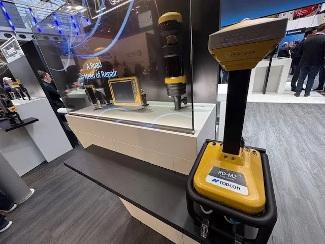
Topcon Positioning System’s new RD-M2 laser scanner has been purpose-built for road resurfacing applications.

The vehicle-mounted downward-facing RD-M2 delivers precise surface conditions over long and complex roads, which means no road closures are needed.  

Millions of points are collected by the vehicle operator from safety of his or her cab.

The 3D point data from the RD-M2 scanner serves as the basis for detailed road surface designs using the Topcon Office Suite.  

These ground-truth surfaces are a part of the company’s SmoothRide system workflow.

Users can take advantage of Topcon’s intuitive workflow to create their own custom design from the scan or they can integrate a predefined template.  

Users can also align the scan to the local coordinate system with millimetre-level precision, providing complete flexibility for road resurfacing projects.  

For more information on companies in this article

Related Content

  • Philipp Swarovski lays down the marker
    June 10, 2019
    Swarco’s chief operating officer Philipp Swarovski shares his thoughts on highway safety and infrastructure in an age of uncertain future needs. David Arminas reports It was in Austria in 1969 when Manfred Swarovski opened his first glass bead factory. Five years later, operations started in the US. As the years rolled by there followed acquisitions and expansion of manufacturing facilities as well as a shift into intelligent transportation systems globally. Fast forward to 2019 and the family compan
  • Generate real-world ROI with reality modeling!
    September 8, 2022
    Understanding existing site conditions is essential to efficiently design, build, and operate road networks around the world. But how can the real-world be captured quickly and cost-effectively?
  • Permanent repairs at lower costs thanks to JCB’s revolutionary PotholePro machine
    December 15, 2021
    Shock figures from the AA reveal more than £11bn-worth of potholes need repairing across the UK and British digger maker JCB is on a mission to fix them.
  • Accurate utilities detection
    November 26, 2024

    Trimble and Radiodetection are collaborating to improve the technology used in the utility measurement and mapping process. Integrating the Trimble Catalyst DA2 GNSS system and Radiodetection’s RD MapTM+ application and precision locator products helps to streamline utility-locating workflows to provide accurate measurement capabilities and generate underground utilities maps in a single field operation.