Get highly detailed 3D point road surface data from Topcon’s new RD-M2 scanner

April 11, 2025 Read time: 1 min
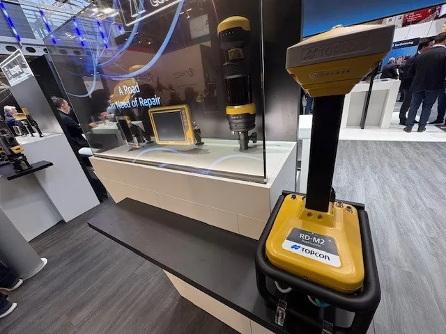
The vehicle-mounted downward-facing RD-M2 from Topcon Positioning Systems delivers precise surface conditions over long and complex roads

Topcon Positioning System’s new RD-M2 laser scanner has been purpose-built for road resurfacing applications.

The vehicle-mounted downward-facing RD-M2 delivers precise surface conditions over long and complex roads, which means no road closures are needed.  

Millions of points are collected by the vehicle operator from safety of his or her cab.

The 3D point data from the RD-M2 scanner serves as the basis for detailed road surface designs using the Topcon Office Suite.  

These ground-truth surfaces are a part of the company’s SmoothRide system workflow.

Users can take advantage of Topcon’s intuitive workflow to create their own custom design from the scan or they can integrate a predefined template.  

Users can also align the scan to the local coordinate system with millimetre-level precision, providing complete flexibility for road resurfacing projects.  

For more information on companies in this article

Related Content

  • Topcon develops advanced software tool
    January 6, 2017
    Topcon Europe Positioning is offering upgrades to its MAGNET software products, which have benefited from the firm’s recent tie-up with Autodesk. The MAGNET Enterprise package is a cloud service that connects the firm’s Field and Office products and provides a web-based interface to company data and new versions of MAGNET Field and MAGNET Office are available.
  • Topcon develops advanced software tool
    February 8, 2013
    Topcon Europe Positioning is offering upgrades to its MAGNET software products, which have benefited from the firm’s recent tie-up with Autodesk. The MAGNET Enterprise package is a cloud service that connects the firm’s Field and Office products and provides a web-based interface to company data and new versions of MAGNET Field and MAGNET Office are available.
  • Concrete paving advance in the market
    December 9, 2022
    New concrete paving technology is now coming to market from Wirtgen, with the firm broadening its product range with new and improved models now available
  • More accurate mapping
    July 31, 2024

    Trimble and Radiodetection have established a collaboration to improve the technology used in the utility measurement and mapping process. Through the integration of the Trimble Catalyst DA2 GNSS system and Radiodetection’s RD MapTM+ application and precision locator products, the software and hardware integration streamlines utility-locating workflows. This can provide high-accuracy measurement capabilities for the generation of underground utilities maps in a single field operation.