EarthSense Systems releases air pollution map of the UK

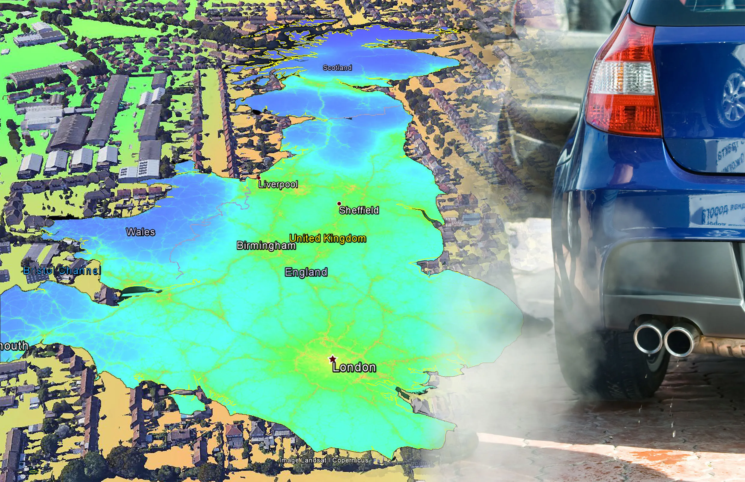
EarthSense Systems has published MappAir, a high-resolution map of air pollution throughout the entire UK. MappAir shows how air pollution - specifically nitrogen dioxide - changes across the country and within towns and cities, highlighting likely sources and potential clean-air refuge areas. It combines data from satellites and its EarthSense Systems’ own air quality monitoring sensors along with open source data. The result, using complex modelling, creates a highly accurate map at 100m resolution, says
June 15, 2018 Read time: 3 mins
The comings and goings of the UK’s air pollution, according to MappAir, a high-resolution map
EarthSense Systems has published MappAir, a high-resolution map of air pollution throughout the entire UK


MappAir shows how air pollution - specifically nitrogen dioxide - changes across the country and within towns and cities, highlighting likely sources and potential clean-air refuge areas.

It combines data from satellites and its EarthSense Systems’ own air quality monitoring sensors along with open source data. The result, using complex modelling, creates a highly accurate map at 100m resolution, says James Eddy, managing director of EarthSense Systems.

“There simply isn’t enough [air quality] data available for those charged with tackling the issue to make informed decisions. MappAir provides a street-view to citywide visualisation of air pollution and is the first in a series of nationwide products that are coming to market in the next year.”

Using the British National Grid, EarthSense has divided the UK into 100m-squares – about twice the size of an average football pitch. Air pollution readings from satellites and its own Zephyr air quality monitoring sensors are combined with open data, including traffic emissions and weather conditions, to produce an annual average for each cell.

As additional sensors come online and more historical data becomes available, EarthSense says that it will produce a range of MappAir products. These include an ultra-high resolution 1m dataset for detailed study areas and a 10m map for urban areas. There will be a historic time series of maps showing how air pollution changes over the course of a day and on different days. Forecast maps will give an indication of fluctuations up to three days ahead.

EarthSense will also be releasing a map of PM2.5 - ultrafine pollution particles smaller than 2.5 micrometres. “Not only does it differ from location to location, as MappAir clearly shows, but it also changes from morning rush hour to afternoon school run and from weekday commutes to weekend leisure pursuits,” says Eddy. “This is why we are already working on the next products in the MappAir range, including near real-time altering maps and forecast maps.”

EarthSense has already undertaken a range of air quality monitoring projects, including trials of an airborne air quality mapper, air pollution monitoring equipment on a rocket and mobile mapping with air quality sensors mounted in electric cars. Future plans include the establishment of a nationwide network of air quality monitoring sensors that will feed live data for up-to-the-minute air quality predictions.

EarthSense Systems is a joint venture between UK aerial mapping company Bluesky and the University of Leicester in the UK. Bluesky is a specialist in aerial surveying including aerial photography, LiDAR and thermal data. It uses survey technology, including two UltraCam Eagles and a Teledyne Optech Galaxy LiDAR system integrated with a PhaseOne camera and thermal sensor.

EarthSense is also developing solutions for other environmental applications, including a National Tree Map, solar mapping and citywide heat-loss maps.

Related Content

  • Concern at worsening road safety worldwide
    May 22, 2019
    The latest road safety data from the World Health Organisation (WHO) provides a serious cause for concern. The annual global road fatality rate has increased in the three years since the WHO last carried out a study of worldwide crash statistics. The report says that 1.35 million people are now killed on the world’s roads every year, compared with a figure of 1.25 million three years ago. The problem is particularly acute in the developing world, where increasing vehicle numbers combine with poor levels
  • Hot work for GOMACO at Doha airport
    November 2, 2012
    The country of Qatar, located on the Persian Gulf, developed a master plan to build a new replacement airport in its capital city of Doha, the New Doha International Airport, in 2003. Its goal is to have a facility capable of handling 50 million passengers; two million tons (1.8million tonnes) of cargo, and 320,000 aircraft landings and take-offs each year by 2015. Phase one of the aggressive project is scheduled for completion early next year. The Tayseeir Contractors Company Joint Venture, including Conso
  • Estonia surveys major roads with a RetroTek-M retroreflectometer
    May 22, 2019
    During the past two years, Estonia’s Road Administration has clocked up 4,021km during a retroreflectivity project on all main state roads and on basic roads. Estonia’s Road Traffic Development Department of the Estonian Road Administration has been working with ERC Consulting to gather retroreflectivity data on road markings on all main state roads and basic roads. The work has shown that out of 1,609km of main state roads, 20% had problems. The reflective effect is created by glass beads on the surf
  • Smarter compaction equipment from key manufacturers
    June 23, 2015
    Intelligent compaction technologies continue to advance in sophistication - Mike Woof writes Ever more sophisticated intelligent compaction technologies are being offered to customers, which can boost working efficiency and help improve construction quality. This is particularly the case for the compaction of asphalt running surfaces. Asphalt cooling leaves only a short time window during which a paved mat can be properly compacted, so intelligent compaction systems offer major gains for contractors and cli