When it is finished in early 2017, the causeway on Auckland’s North-western Motorway, State Highway 16, will have been raised 1.5m to stop flooding at extreme high tides. There will be four lanes city-bound and four/five lanes westbound with dedicated bus lanes in each direction, and the existing North-western cycleway that runs alongside it will be upgraded.
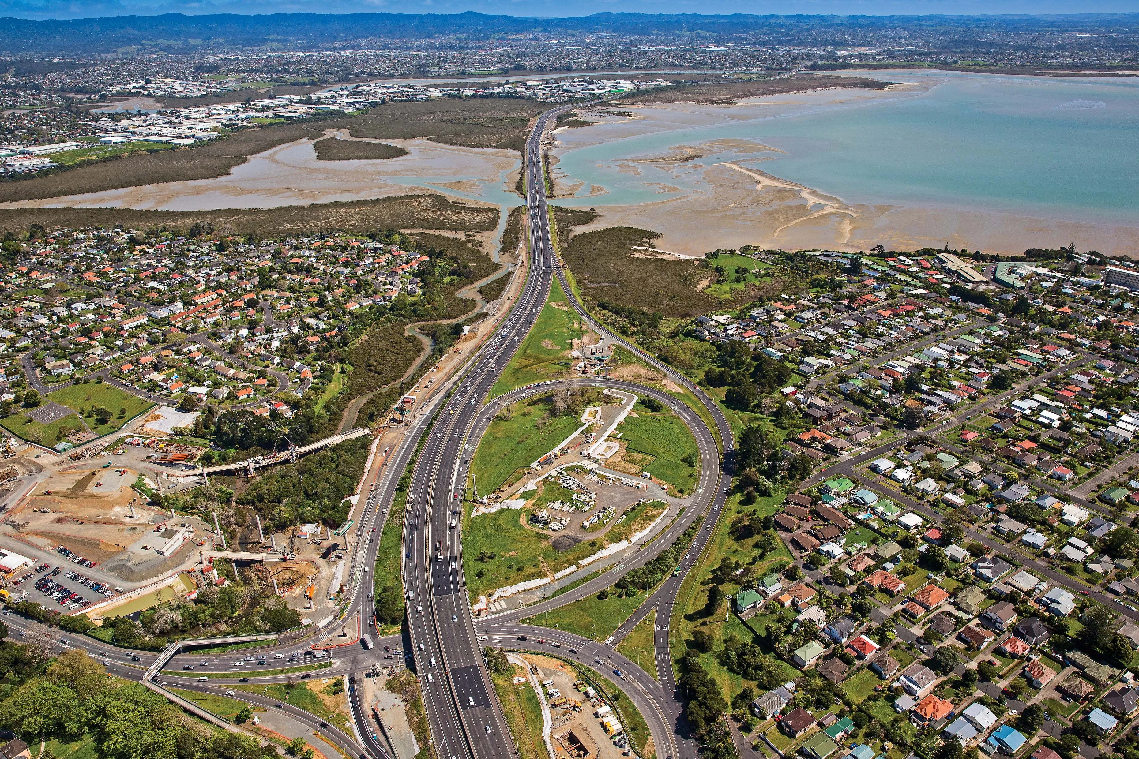
When it is finished in early 2017, the causeway on Auckland’s North-western Motorway, State Highway 16, will have been raised 1.5m to stop flooding at extreme high tides. There will be four lanes city-bound and four/five lanes westbound with dedicated bus lanes in each direction, and the existing North-western cycleway that runs alongside it will be upgraded.
More than 10,000 wick drains have already been installed to accelerate consolidation of up to 15m of alluvial marine mud as part of the NZ Transport Agency’s 4.8km, US$183.3 million (NZ$220 million) Causeway Upgrade Project. “Intensive ground reclamation like this is an important part of the project’s work to upgrade and improve this section of the motorway. We are mindful to protect the marine reserve environment where we are working, installing new bird roosts for species which inhabit the area, and silt fences,” said the Transport Agency’s highways manager, Tommy Parker.
A 2-3M-deep drainage blanket using more than 26,000 truckloads of 19-25mm recycled aggregate has been spread on top of the wick drains. When the settlement has stabilised, construction of new motorway lanes will start on top of it.
The Causeway Alliance – the NZ Transport Agency, AECOM, Coffey, Fulton Hogan, Leighton Contractors and Sinclair Knight Merz – is completing the upgrade.
The project is one of five underway or planned to finish the 47km-long Western Ring Route along the South-western, North-western and Upper Harbour motorways, which is identified by the Government as one of its Roads of National Significance to support New Zealand’s economic growth.
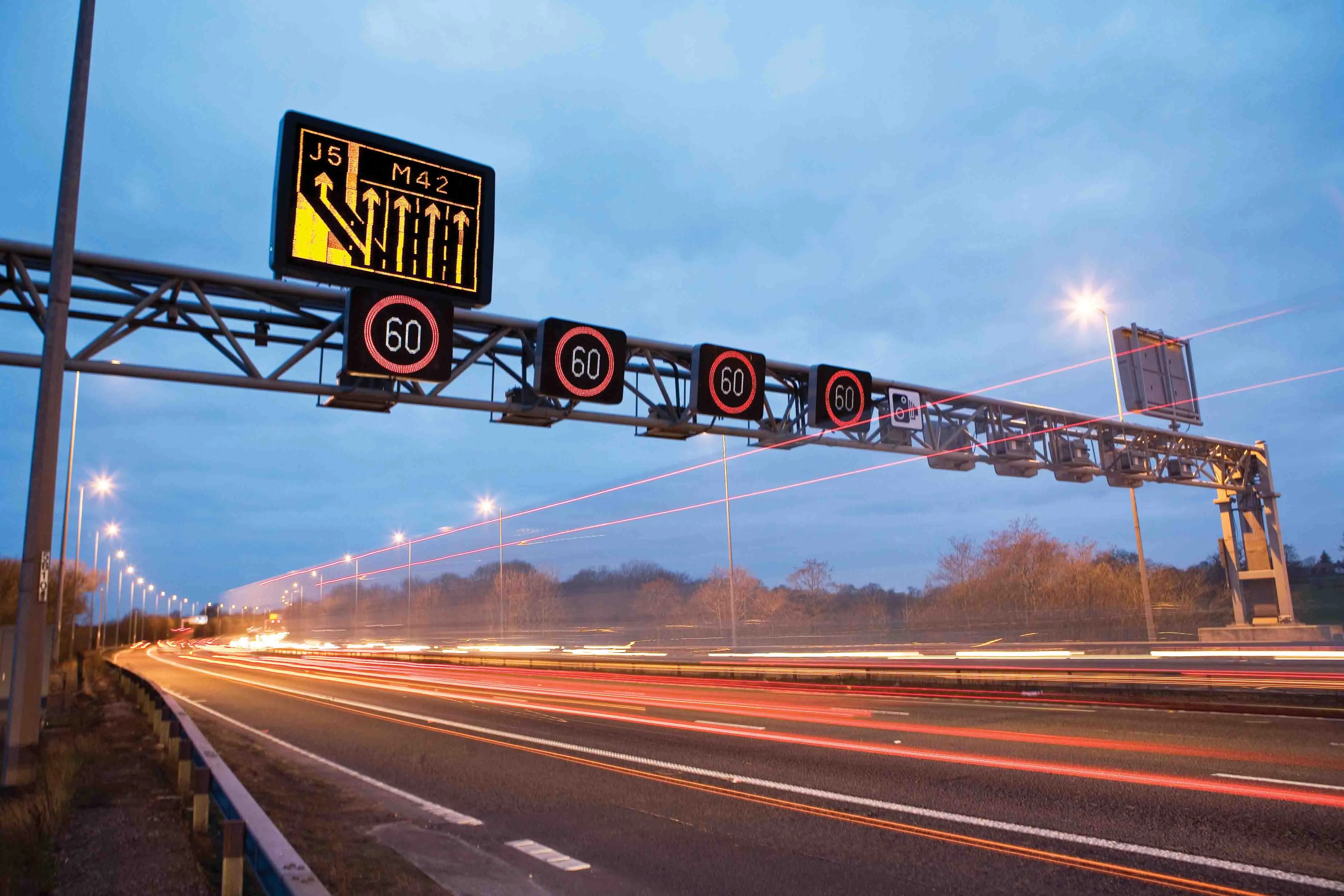
The project is the first in New Zealand to adopt temporary orange marking tape to improve lane definition and enhance driver safety. Maintaining traffic flow of almost 100,000 vehicles/day while upgrading this section of the state highway network is a key challenge and driver cooperation is essential.
Mr Parker said that for the first time, Auckland will have direct motorway access between the central business district and the airport, and the Western Ring Route will also better connect people and freight with the city’s rapidly growing areas in the north-west and south-west.
“It’s a key part of a massive investment in infrastructure needed to meet the demands of rapid economic and population growth underway in the top half of the North Island,” he said.
More detailed information on this project will be included in a feature in the April issue of World Highways.
More than 10,000 wick drains have already been installed to accelerate consolidation of up to 15m of alluvial marine mud as part of the NZ Transport Agency’s 4.8km, US$183.3 million (NZ$220 million) Causeway Upgrade Project. “Intensive ground reclamation like this is an important part of the project’s work to upgrade and improve this section of the motorway. We are mindful to protect the marine reserve environment where we are working, installing new bird roosts for species which inhabit the area, and silt fences,” said the Transport Agency’s highways manager, Tommy Parker.
A 2-3M-deep drainage blanket using more than 26,000 truckloads of 19-25mm recycled aggregate has been spread on top of the wick drains. When the settlement has stabilised, construction of new motorway lanes will start on top of it.
The Causeway Alliance – the NZ Transport Agency, AECOM, Coffey, Fulton Hogan, Leighton Contractors and Sinclair Knight Merz – is completing the upgrade.
The project is one of five underway or planned to finish the 47km-long Western Ring Route along the South-western, North-western and Upper Harbour motorways, which is identified by the Government as one of its Roads of National Significance to support New Zealand’s economic growth.
The project is the first in New Zealand to adopt temporary orange marking tape to improve lane definition and enhance driver safety. Maintaining traffic flow of almost 100,000 vehicles/day while upgrading this section of the state highway network is a key challenge and driver cooperation is essential.
Mr Parker said that for the first time, Auckland will have direct motorway access between the central business district and the airport, and the Western Ring Route will also better connect people and freight with the city’s rapidly growing areas in the north-west and south-west.
“It’s a key part of a massive investment in infrastructure needed to meet the demands of rapid economic and population growth underway in the top half of the North Island,” he said.
More detailed information on this project will be included in a feature in the April issue of World Highways.